Cabo via Mexicali – May, July & October 2021
May 2021 – California (Calexico) to Cabo
Having ‘cut our teeth’ back in January navigating the rugged Baja coastline, we had heard that the Mexicali check-point was slightly quicker than Tijuana so thought we would give it a try. We were actually pleasantly surprised, not only did it reduce our trip time by several hours, it also had a much smoother terrain which meant you could drive at higher speeds more consistently. Other than that, the only difference going this way versus Tijuana is that you are crossing to Guerrero Negro from the east side of Baja instead of the west. From Guerrero Negro to Cabo, the remainder of the trip is identical.

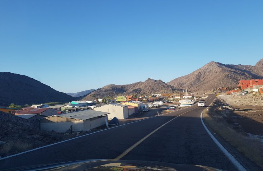
The drive down the east of Baja California presents you with many spectacular sights that will simply take your breath away and you may feel compelled numerous times to stop and take it all in (or snap some pics).
DAY 1 – El Centro to Santa Rosalia | 832 km’s (517 miles)
Our journey started pretty close to the border at El Centro staying at Hampton Inn El Centro which is very well located to plenty of shopping and restaurants if you get into town early and only about 30km’s (18 miles) from the Mexicali checkpoint.
The checkpoint itself was pretty similar to Tijuana although this time we found the immigration office pretty easily and were the only people in the queue to obtain a visa. All over in about 10 minutes and we were back in Mexico with a new 6-month tourist visa (will refresh every time you cross although we later learnt that if you still have a few months remaining on current visa, they may leave it as is unless you ask them to stamp a new one)
We had intended stopping only one night this time (versus 3 nights the 1st time) staying in Guerrero Negro for the night but, given we had started our journey so early (around 8am), we arrived at Guerrero Negro around 4pm so decided to continue on to Santa Rosalia which is about 1.5 hrs (220km’s) further down the road on the east coast.
Santa Rosalia is a port city with a regular ferry service to Sonora on the Mexico mainland opposite. Once a copper mining town, mining ceased in 1954 but a lot of the old machinery and industrial equipment remained which you can readily see as you drive through the town.

As the sun was starting to fade as we drove in and had not booked any accommodation, we took a chance on a hotel positioned on the beach, Hotel Las Casitas Santa Rosalia and was fortunate that there was one remaining room available.
While the room was pretty basic and somewhat outdated, the parking was free and it was pretty well located to town. It did have some pretty good front row seats to the sunset though which was spectacular.
DAY 2 – Santa Rosalia to Cabo San Lucas | 704km’s (437 miles)
The next morning we were up early and on the road. Whilst Google Maps told us we still had a 9+ hour drive before reaching Cabo, we learnt that Google forecasts on an average speed of 80km’s/hr (50 mph) and we were easily traveling 100km’s or higher for most of the journey so would shave off hours from the forecast.
Leaving around 9am the next morning, we passed through the scenic towns of Mulegé and Loreto before crossing back inland through Ciudad Insurgentes, down to La Paz taking the Federal Hwy 19 all the way to Cabo San Lucas.
We arrived home in Cabo / El Tezal around 4pm (after a decent stop break in La Paz) and patted ourselves on the back for being able to easily achieve what we had set out to do – California to Cabo in 2 days!
July 2021 – Cabo to California back to Cabo
The first time we did the return trip from Cabo to CA via Mexicali was in July and experienced relatively few issues but did learn some valuable lessons.
DAY 1 – Cabo San Lucas to Guerrero Negro | 923 km’s (574 miles)
Upon leaving Cabo, we challenged ourselves with a long 10 to 12-hour day driving 920km’s (approx) to spend our first night in Guerrero Negro which is referenced as the ‘mid-way’ point of Baja California. This meant we were able to reach the Mexicali border in just 2 days and so were pretty pleased with our efforts. It helped that we left Cabo around 6am so that we were able to avoid any night-time driving, getting in to Guerrero around 5pm with only a couple of very short break-stops along the way.
This being our 2nd time stopping at Guerrero Negro, we chose to stay at The Halfway Inn which is pretty close to the center of town and, similar to our previous stay at Hotel TerraSal, – both are super-easy on the budget with basic, clean rooms and restaurants offering a decent hot breakfast and dinner (not included in room cost but good value at approx. $6 usd per person). Average cost per night online is approx. $50 usd (as of Nov 2021).
We prefer, however to stay at Hotel TerraSal but they really are both quite similar. To book TerraSal, you really need to reach out to them on their Facebook page (https://www.facebook.com/HotelTerraSal) and send them a message in advance- they take a day or two to reply – or you can just risk it by turning up – they generally have rooms available but we have experienced them being booked out also – especially when there are additional workers in town for the nearby salt mines or road construction.
It is worth noting that both hotels are very minimalist in their rooms – this means no bar fridge, limited TV channels (that are primarily in Spanish) and fairly thin blankets on the beds (Guerrero Negro can get very chilly in Winter at night).
I would also recommend taking some of your own pillows for the drive down – especially if you’re picky about pillow comfort like we are.
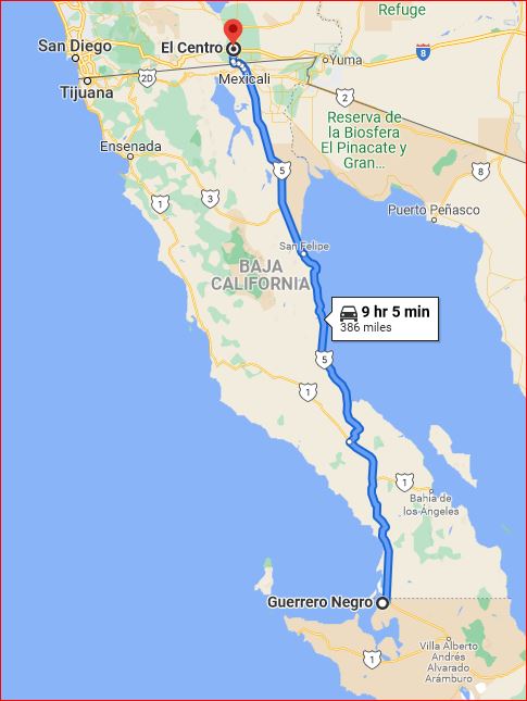
DAY 2 – Guerrero Negro to El Centro | 621 km’s (386 miles)
Before leaving Guerrero Negro, make sure to fuel up as a large part of the drive involves travelling from westt to east coast with not a lot of sign of life in-between.
You initially start your journey in the same direction as if you were travelling to Tijuana so follow Carr. Transpeninsular/Guerrero Negro – Lázaro Cárdenas/México 1. About 180 km’s (115 miles) into the journey you turn right onto BC 5/México 5 and travel for a further 215 km’s (133 miles) before arriving at Baja’s stunning eastern coastline.
From here, it is a fairly direct drive of approx 200 km’s (120 miles) along the coast . We stopped at the popular beach town of San Felipe to fuel up before making our way to the Calexico border crossing. Once you pass through San Felipe you have about 195 km’s (121 miles) before arriving in Mexicali.
Mexicali has both an east and west border crossing station with west being the more common one for standard vehicle travel and open 24-hours (eastern border crossing is only open 6AM – 2PM).
Arriving mid-afternoon, we headed to the west crossing and expected a long wait of 1-2 hours however found that we were guided by our car navigation system to the ‘Sentri’ lanes (a dedicated lane reserved for expedited pass holders to which you need to apply for pre-approval with the Department of Homeland Security). This meant we found ourselves in an ‘express’ lane so had practically no wait time at all.
**Important note: you will have to ignore your satellite navigation guidance telling you to follow the instruction ‘Turn left to merge onto Carril Sentri‘ unless you have a sentri/ready card.
Seems many people make this mistake with Google Maps being the main offender. Once we had explained our error to the border official, we were given a warning that allowed us a ‘one-time only” error and granted approval to cross the border. If we were to use Sentri lane again without a pass, we cop a $5Kusd fine (which the do charge you for after reading comments online).
If you are wanting to get to the regular lanes please note the following directions instead;
Stay on Mex 5/Mexicali-San Felipe Rd until it turns into Blvd. Adolfo Lopez Mateos ( this occurs with a slight veer to the left crossing over Calz. Gustavo Vildósola Castro )
Continue along Blvd. Adolfo Lopez Mateos until just before reaching Ave. Francisco L Madero where you make a right turn into a road called Azueta
From here, you will cross over Ave. Francisco L Madero until you reach the next major road called Cruce Internacional Mex-USA / Cristóbal Colón
Turn left on to Cruce Internacional Mex-USA / Cristóbal Colón following the signs to the regular border crossing lanes
Lesson #1| It is important to note that once you have turned on to Carril Sentri, you can’t turn around so make sure you DO NOT enter this road unless you have the required pass.
Lesson #2| We later observed that we hadn’t received a fresh visa stamp in our passports likely as a result of still having about 3-4 months remaining on our last US Visa stamp. If you are wanting to have the max allowed stay time, then be sure you ask for a new visa stamp to re-set your allowed visa ‘stay’ time! This applies in BOTH directions.
Once through, we headed to El Centro to rest for the night before continuing our journey up north to Sacramento. Being less than 30 km’s (< 20 miles) from the border crossing means you only have a short trip before you can rest which may be a relief if you do end up with a 2-hour wait in the queue to border cross.
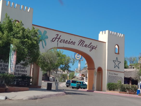
Welcome sign to the quaint seaside town of Mulegé 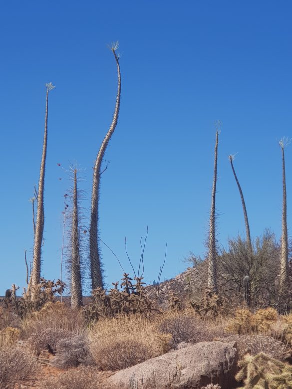
‘Dr. Seuss’ looking Boojum trees 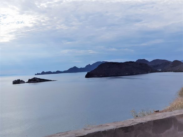
Magnificent eastern-Baja coastline
October 2021 – Cabo to Mexicali…then back to Cabo!
We had booked tickets to see The Eagles in Sacramento, CA so decided to drive up and back and combine the trip with visiting family and friends in and around Placerville/Folsom.
Same as in previous trips, we left early in the morning to reach the mid-way point of Guerrero Negro before nighttime. Staying again at Hotel TerraSal, we left the following morning early to get to the border crossing in Mexicali around mid-afternoon.
Pete, my husband, had read a blog about taking the east border crossing instead of the busy west with indications there would be less wait time. Much to our disappointment, when we arrived at the east border crossing, the lane for regular traffic was blocked and indefinitely closed. This meant winding our way across to the east (along with many other hopefuls who had had the same idea as us.
The queue was long – very long – we had arrived about 3pm and settled in for a slow crawl whilst being entertained by hawkers who make a regular living selling various souvenirs, food, etc to the continuous line of slow-moving traffic.
After about an hour and a half, listening to best hits of The Eagles in anticipation of the concert, we reached the border security guard who asked us what our essential reason was for crossing in to the US? Given we also had to renew or Californian driver’s license on this trip my husband use this as a key reason (we didn’t think attending The Eagles in concert would be considered ‘essential’).
We were denied entry!
Whilst we were aware of land border restrictions between US/Mexico/Canada, it simply hadn’t occurred to us that we would have any issues (naive I know). Given we had passed through the border in July without question, we simply didn’t think we would be rejected. On reflection, we realise that, because we had accidentally taken the ‘sentri’ lane last time, it unintentionally gave us border entry approval.
So – after two days of driving (and a bit of pleading), we simply had no choice but to turn around and head back to Cabo!
Given it was starting to get dark, we decided to head back to San Felipe 204 km’s (127 miles) away to at least make a dent in the journey back down Baja Peninsula to Cabo. That night, after sadly selling our concert tickets on line, we arranged flights for the following Wednesday to fly out from Cabo to San Francisco. As it was already Saturday, the earliest we could make it back to Cabo would be Monday night so flying out on the Wednesday meant we only lost a couple of days.
Ironically, the land border restrictions eased on November 8th, 2021 so we only fell short by two weeks.
Cabo to Mexicali in Summary | 1,509km’s (938 miles)
- Prettier drive with more breathtaking coastline views than if you were to go via Tijuana
- Leave Cabo (very) early in the morning if you wish to reach Guerrero Negro on your first night
- Ignore your satellite navigation should it tell you to turn into Carril Sentri when you are wanting to use the regular traffic lanes
- Expect 1-2 hour wait in the queue at the border crossing and factor this in to your total journey time
- Given the current climate with regards to travel during a pandemic, check land border restrictions before your journey
Mexicali to Cabo in Summary | 1,509km’s (938 miles)
Will likely take this route for future trips for the following key reasons;
- Quicker drive time to Guerrero Negro
- Roads are smoother (lot of the roads have had upgrades recently)
- More towns which means more frequent fuel-up opportunities
- Did I mention quicker drive to Guerrero Negro (avge 2-hour saving which is quite significant overall)??
- If you can afford the time, it is worth it spending a night in or around San Felipe
Is it possible to drive the Baja in one day? – Feb 2023
With a distance of just over 1,500 km’s (830+ miles), it seems a pretty daunting task to tackle Baja top to bottom in just one day. According to Google Maps, you are looking at a drive-time of almost 18-hours but you need to keep in mind that Google maps calculate time based on what the speed limits are (which is 80km/h most of the journey.
So can it be done? Well my husband proved it can. Needless to say, he was by himself and free to travel at whatever speed he could without me screaming at him to slow down; and he did start his journey at around 5am arriving in to San Lucas at about 9.30pm.
Would he do it again? Probably not, although he would be more likely to consider it if he were to start from San Felipe which is 200 km’s south of the Mexicali border crossing but even then, you’re looking at a long day.
Personally I wonder why you would even want to – it’s such a beautiful scenic drive down and it is much more enjoyable to make a number of stops along the way.
My recommendation for the ideal N-S Baja Road-trip
If you have the time, my thoughts on the ideal North-South Baja road trip takes about 5 days from Temecula in southern California to Cabo San Lucas. If this is your first time driving the Baja and you have the time, then I strongly recommend you spending some quality time along the way.
Below outlines the stops I would take if I wasn’t in a hurry;
- Night 1: Stay in Temecula as your initial ‘leaving’ point CA (El Centro is closer to border crossing but Temecula is sooo much prettier!) – it’s a 4-5 hour drive (465 km / 290 mile) depending on your speed and how smooth your border crossing goes (the earlier you cross, the less banked up the traffic))
- Night 2: Cross the border through Mexicali at a leisurely pace and plan a stay in San Felipe – great little seaside holiday town that has a great marina and boardwalk to enjoy and the town is simply a hive of activity at night time with plenty of restaurants to choose from
- Night 3: Head across towards Guerreo Negro in the morning, perhaps stopping there for lunch taking about 4 1/2 hours to get there sticking to the road limit (394 km / 245 mile) . Then head on to plan a stay in either Santa Rosalia (a further 220 km / 137 mile) or the delightful scenic town of Mulegé (282 km / 175 mile).
- Night 4: Take a relaxing day doing an easy 140 km (87 miles) to the beach-side town of Loreto (if starting from Mulegé) and plan a day here to take in the sights walking the Malecon which takes you along the esplanade to the centre of town which is a delight to see. This scenic route along the beach/marina esplanade to the cobblestone streets of downtown leads you to a delightful town square with plenty of restaurants offering delicious Mexican dishes, it really is a lovely way to press ‘pause’ on all your driving
- Final Day: If you’re ready to now head to final destination Cabo where you take a 5-6-hour journey (509 km / 316 mile) stopping at La Paz for a late lunch along the way.
Indulging in this route will have you arriving at the southernmost tip of Baja California quite well-rested and with a new appreciation of the Baja coastline and all it’s delightful coastal towns.


Comments
Trackbacks & Pingbacks
[…] Cabo via Mexicali – May 2021 […]